The Maniototo
The Maniototo is a region made of plains and mountains in the South Island of New Zealand. As names go, through to the early 1900s the Maniototo used to be known as Central Otago, during which modern day Central Otago (Cromwell, Queenstown, Wanaka, …) was known as The Interior.
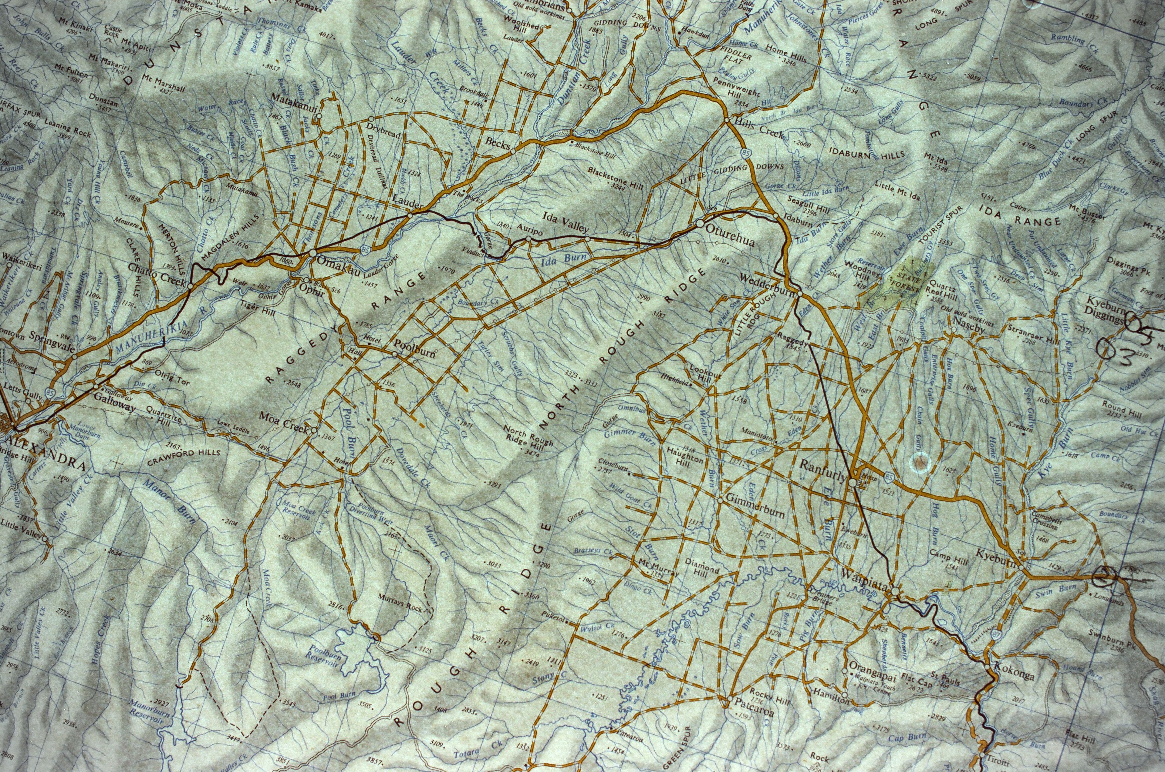
A rough map was made in 1852, with a more formal map published a few years later. This tale from Down the Years in the Maniototo (1948) by Janet C. Cowan.
Mr John Turnball Thomson [surveyor] … made a reconnaissance survey of the north-eastern districts of Central Otago in October and November, 1857, when he named most of the streams and hills. On a geodesical survey in another part of Otago he gave classical and appropriate names to places. When he showed his map to a member of the Provincial Executive who was a scotsman he was reproved, and asked why he had not given Scottish names as Otago was a Scottish settlement. Mr Thomson, when mapping the Maniototo, thought he would revenge himself, and gave the names as they now stand – Kyeburn, Eweburn, etc
This early Scot-influenced naming was later added to by farm station owners and gold mining camps. Thomson-named features of geography such as Rough Ridge and Rock and Pillar give a degree of pioneering poetics to the landscape. Other names given by Thomson have been superseded. Styx became Paerau (one hundred ridges in te reo Maori), Sowburn became Patearoa (long fortification, the highest peak in the Rock and Pillar Range), and the township of Rough Ridge (not the mountain range) became Oturehua (place where the summer star stands still). There were no Maori settlements in Maniototo when the British explorers first went into the area, but there’s archaeological evidence of earlier Maori habitation throughout the plain. Original Maori names for places in the Maniototo are lost to time, although it’s evident that names such as the Manuherikia and Taieri rivers were never seriously given an anglo name.
Today’s active townships are defined by the the Otago Central Railway – a train line that ran from Wingatui on the east coast of the South Island. The Maniototo portion of the railway was defined by the black line on the map above. Over 123km it climbed to an altitude of 424 metres to Ranfurly, and then across the Maniototo, down the Manuherikia Valley to Alexandra, and back north to Cromwell. Work first started in 1879. It took twenty years for the line to reach the Maniototo at Kokonga, and more quickly moved across the plain with stations opening: Ranfurly in 1898, Wedderburn in 1900, Ida Valley in 1901, Omakau in 1904, Chatto Creek in 1906, Alexandra in 1906, and not making it until Cromwell until 1921. The line was removed in 1991.
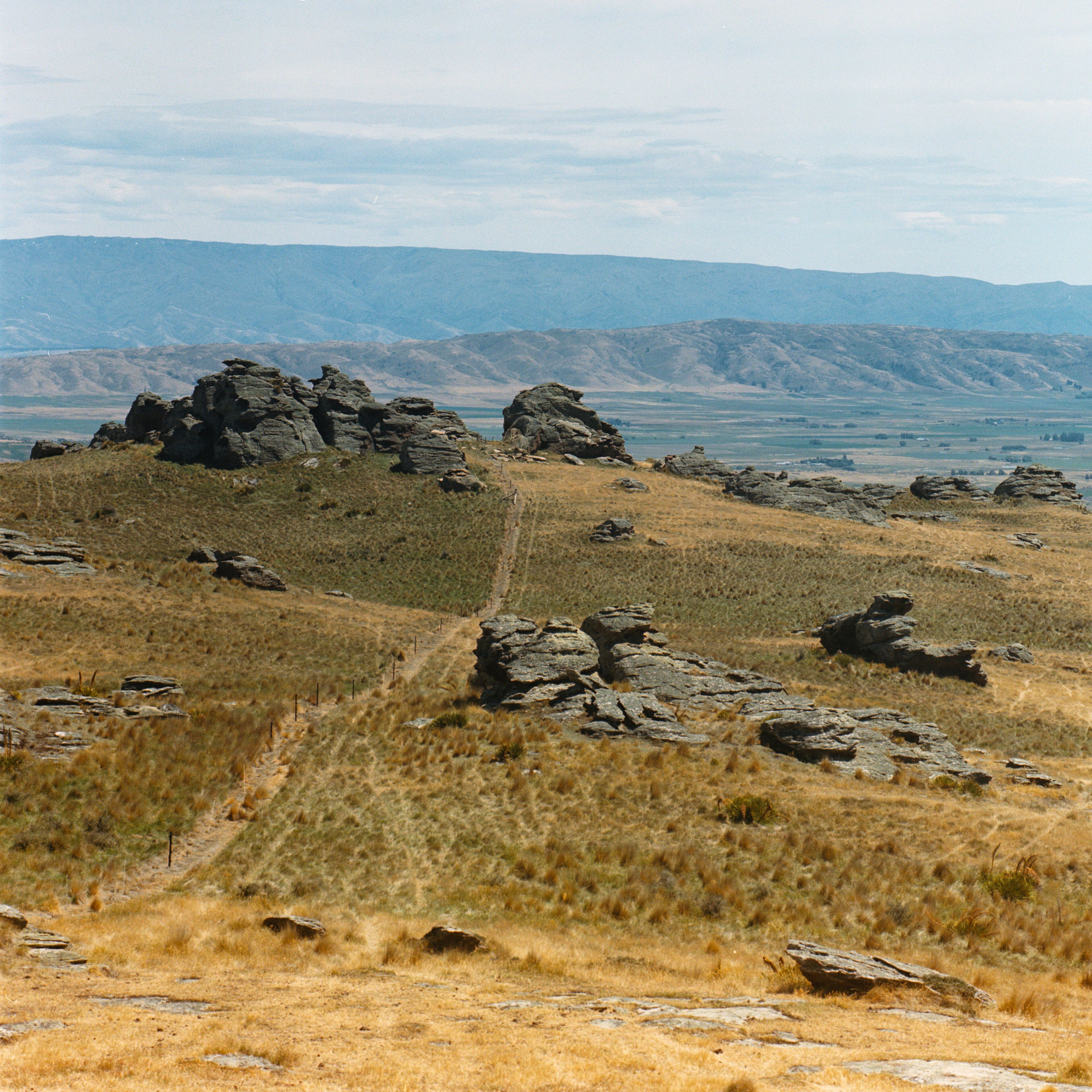
Driving up from Ida Valley to Poolburn
The photograph above is taken from the southern end of Rough Ridge. It looks across the Ida Valley to the Raggedy Range. Behind that, not visible, is the Manuherikia Valley, and standing tall in the background are the Dunstan Mountains. The Otago Central Railway cut through Raggedy Range across a bridged gorge and through a couple of tunnels.
The Otago gold rush began in 1861 with discovery of the Tuapeka field. In 1862 Hartley and Reilly deposited a haul of gold from the Dunstan Gorge launching a new rush there. By the following year claims were springing further up the Manuherikia Valley and by 1863 there was a claim at Dunstan Creek (near Vinegar Hill on the map above). A bunch of Welshmen started working a valley nearby which after a few years became the settlement of Cambrians. Further claims sprung up across the Maniototo, the largest and most yielding fields had townships made around them – resulting in modern day Naseby and St Bathans. Other gold rush towns have been wiped off the map. In 1864 Hamiltons, located south of Ranfurly, had a population of ~4000 people and included 40 stores. By the early 1900s there was little physical trace of the town. Today just a road and cemetery bear the name.
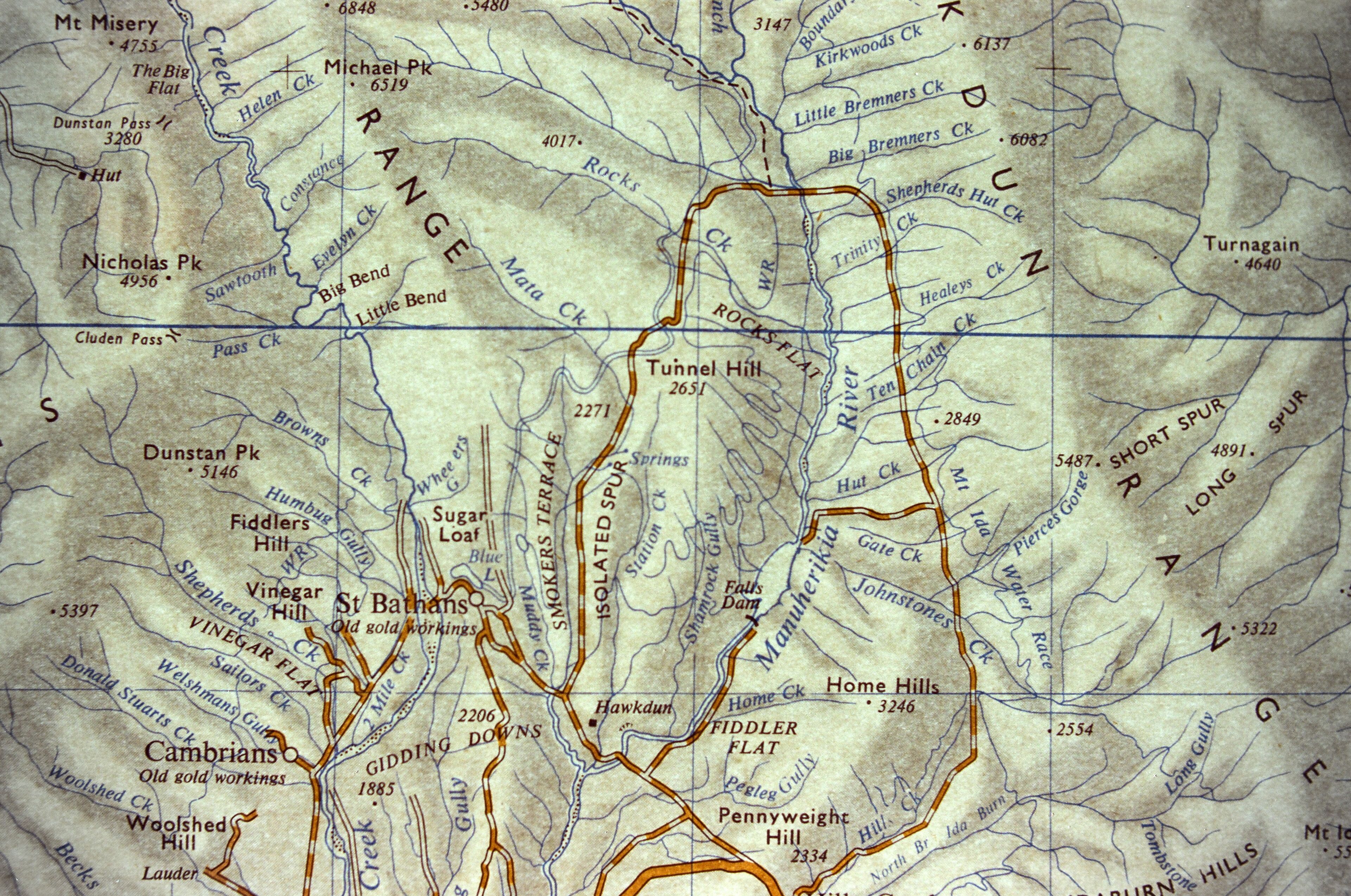
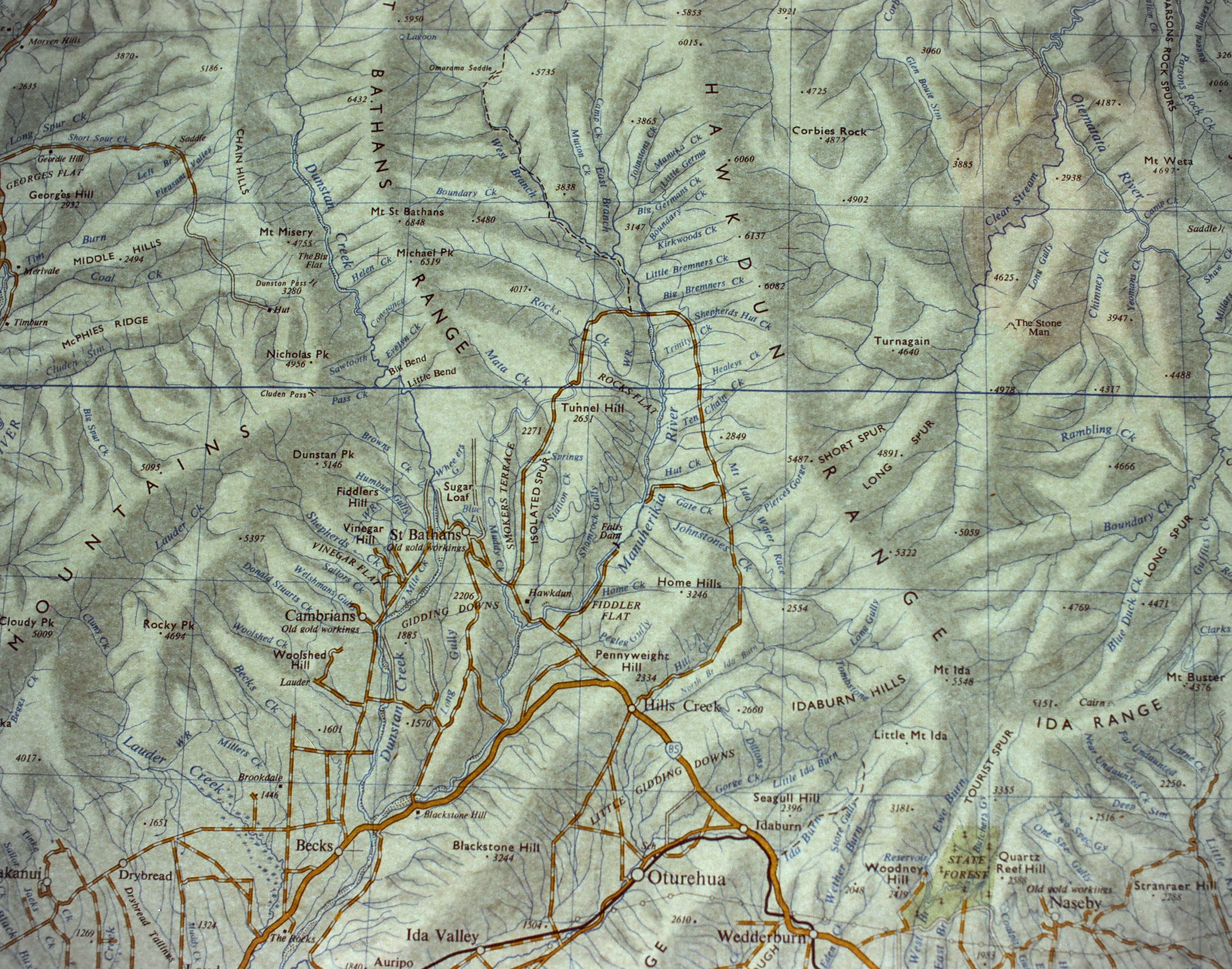
St Bathans and the Ranges. North western Maniototo.
Wedderburn (previously Wetherburn) has no mining history and exists purely because of location. In the mining days it was a stop for the coach travelling across the plains. Later became a stop on the railway line. As soon as the railway station opened at Ranfurly it started pulling business and attention from Naseby. When visiting today, no one would guess that Naseby used to be the commercial and population centre of the Maniototo.
Early accounts from miners making their way to the gold fields describe the lack of trees and vegetation. They had nothing to burn – problematic over winter when snow and frosts are common. Today the mountain tops and ridges are largely unspoiled and uncleared with two exceptions. The first are the decades of wilding pines, spreading from a pine plantation started at Naseby after the mining boom. The second is the green, green grass being managed to feed agriculture. Today when driving around the Maniototo one really only sees farms. Mined and sluiced landscapes have mostly been overgrown, with the exception of what has been intentionally preserved. I’d like to believe that the tops of Rough Ridge, the Hawkdun Range, and other mountains are the same today as they were two hundred years ago – mostly bare, with tussock and matagouri.
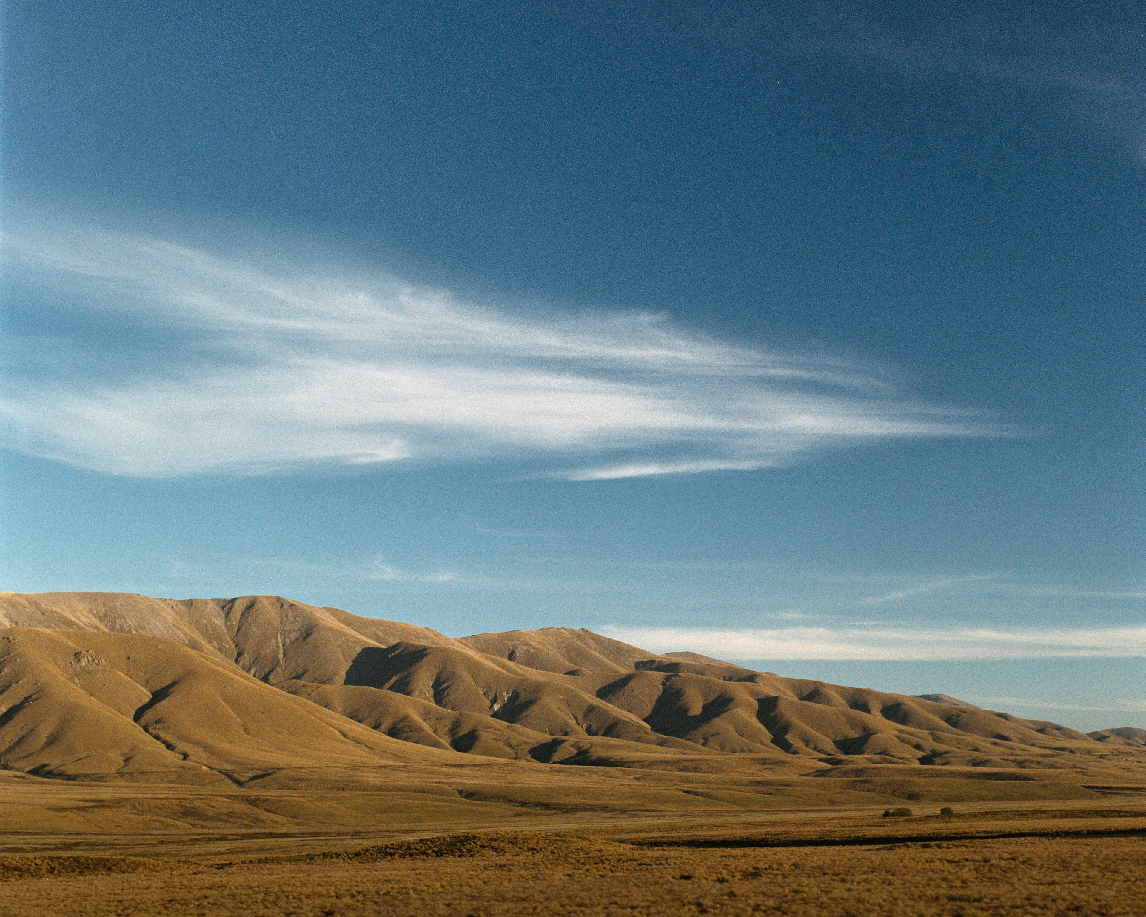
Hawkdun Range.
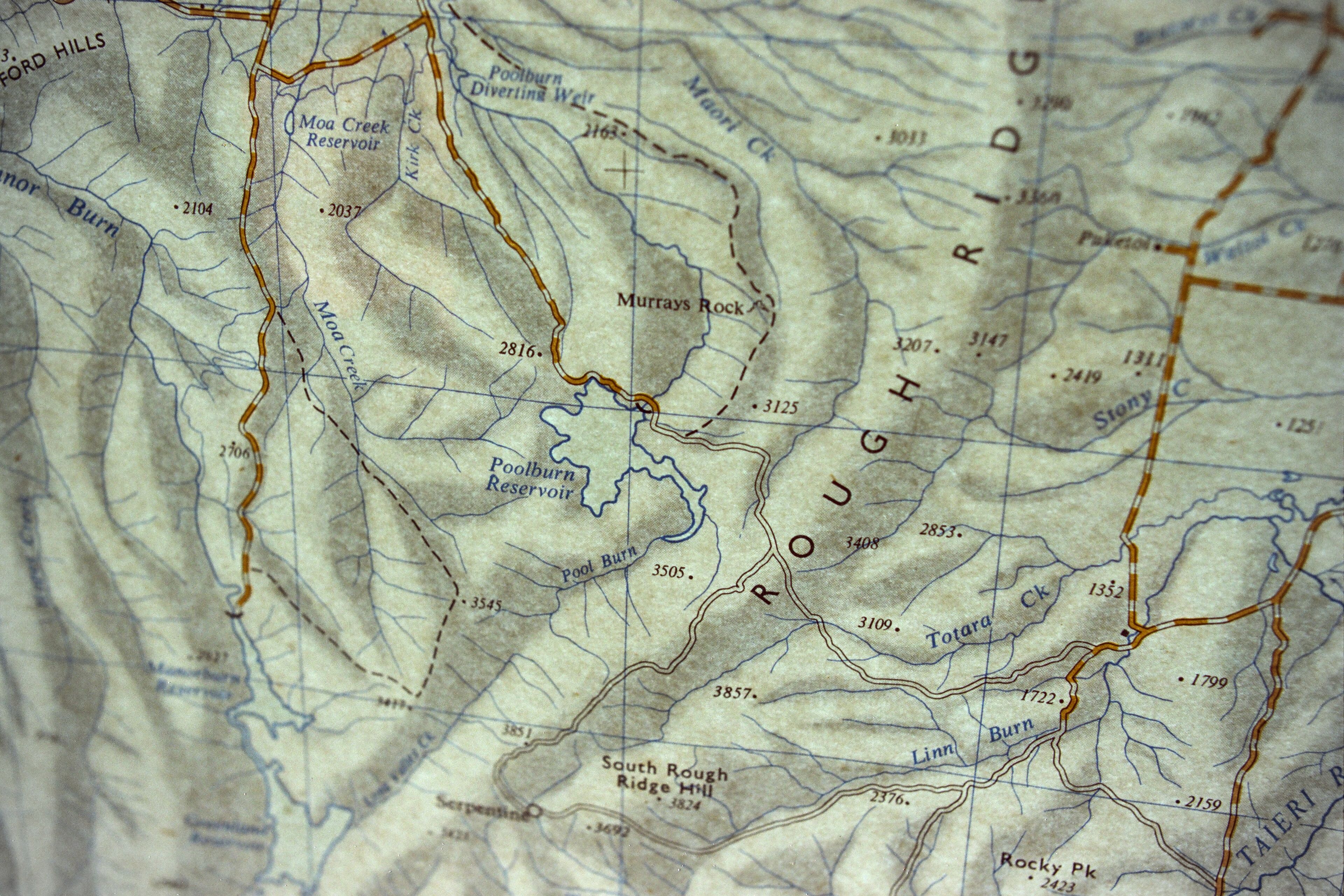
Demand for water was equal for the miners one hundred and sixty years ago as it is for the farmers today. Water races constructed in the 1860s are still maintained. Visible on the map below are the Mt Ida Water Race which receives the westerly runoff from the Hawkdun Range (blue line, to the left of the R in Hawkdun Range). It was constructed as a government project between 1873 and 1877 to promote further mining. Another runs on the opposite side of the Manuherikia River, receiving the runoff from the eastern side of the St Bathans Range and brings water to St Bathans (marked as a river on this map, directly above the T in Tunnel Hill). Not marked on the map is the Dunstan Water Race which runs at the base of the Dunstan Mountains bringing water to Cambrians and the various diggings at the foot of that range (At the foot of Mountains on the left hand side of the map).
Beneath the Hawkduns.
The gold rushes that happened across Otago drew miners and punters from across the world. The closest port they could arrive at was Dunedin, on the east coast of the South Island, and it was a 225km walk for them to get to the Dunstan fields north via the Pigroot. A shorter route was established via Outram that went over the Rock and Pillar and southern edges of Rough Ridge and Raggedy Range, almost a direct straight line on from Dunedin to the fields, but at an altitude that was muddy under snow during winter. This same path can be driven today on the Old Dunstan Road, though it requires a four-wheel drive vehicle and is often closed during winter.
Section of the Old Dunstan Road.
This project came about as an intersection between two interests – the Maniototo, and topographic maps. The map is a 1:250,000 of Oamaru published in 1970. I taped it against a window and photographed it on a 35mm camera using Kodak 250D cinema film. I used a 40mm Voigtlander Ultron lens, in obvious cases with the screw-on close-up lens adapter. View some of my photography in the area:
Further reading, and sources for the information in this blog:
- “Over the Garden Wall” The Story of the Otago Central Railway (1967) – J. A. Dangerfield & G. W. Emerson
- Down the Years in the Maniototo (1948) – Janet C. Cowan