The Taieri River diverted through the tunnel.
The Taieri River starts in the Lammerlaw Range, flows north through the Maniototo Plain, before taking a sharp turn south down the Strath Taieri and Taieri Plain into the Pacific Ocean. The 1860s brought a gold rush to Otago, and while sites along the Taieri River didn’t pay as much as those along the Manuherikia or Clutha rivers, gold was still found.
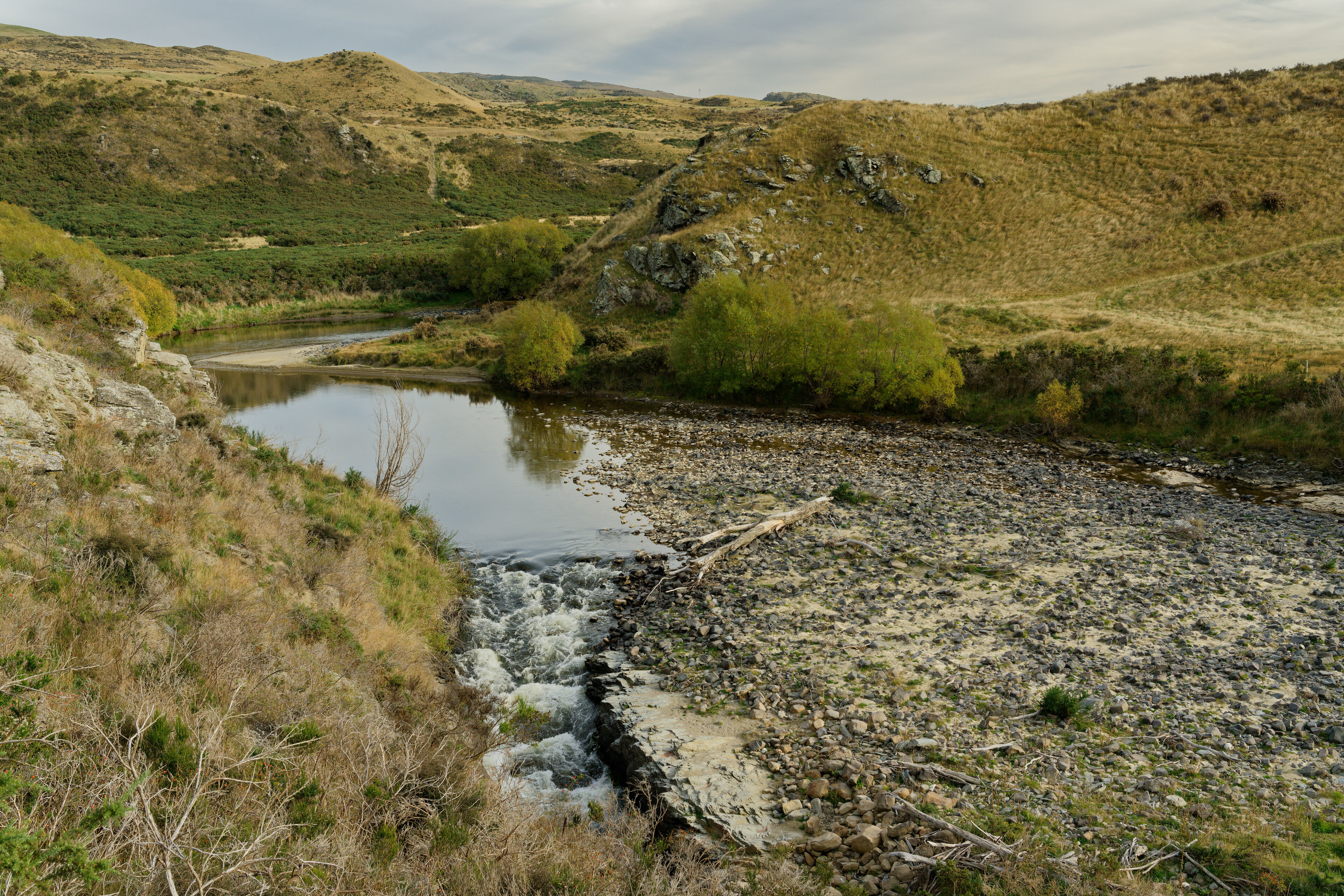
Panning, sluicing, and eventually dredging was done in the upper Taieri near modern day Styx and Serpentine. Further downstream, and up on the hills from the river, at Hamiltons and Hyde remain tailings that are still visible today. While these tailings are slowly overgrown by grass and trees, it’s near Hyde that we see a permanent fixture cut into the landscape. At a place where the Taieri River flows around a small ridge to make the shape of a horseshoe, a tunnel was cut to divert the river and expose the sand, silt, and stone of the riverbed for mining.
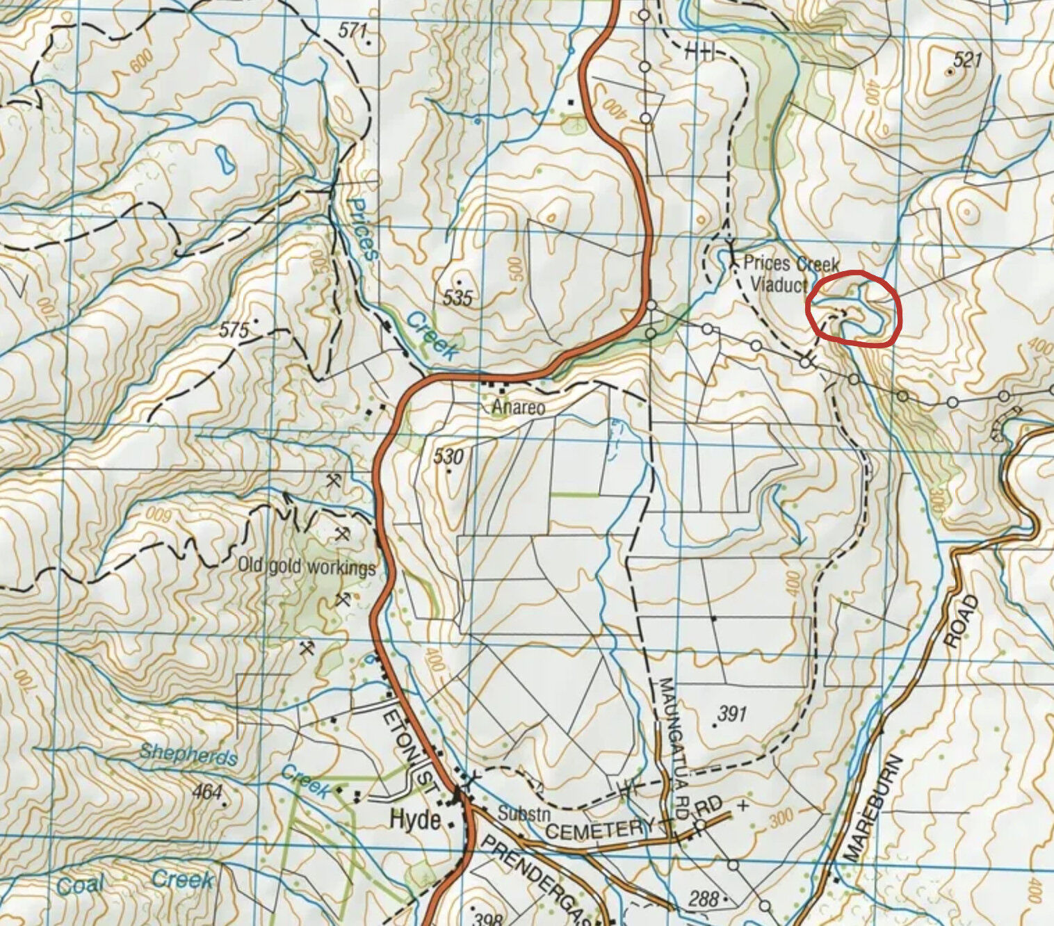
Location of the tunnel circled in red.
In researching history about this tunnel I find no primary sources. Old newspaper records document the mining, sluicing, and water races constructed in nearby Hyde, but I find no mention of the construction of this tunnel, or the mining that was presumably done on the exposed river bed. The story generally told is that the tunnel was blasted after the Hyde gold boom had ended (no earlier than 1865), possibly by Chinese miners who recently moved into the area. The river bed was likely mined, as mullock heaps are visible beside it.
Elsewhere in Otago a similar river diversion, the Oxenbridge Tunnel, was constructed on the Shotover River in 1906 to expose the river bed for mining.
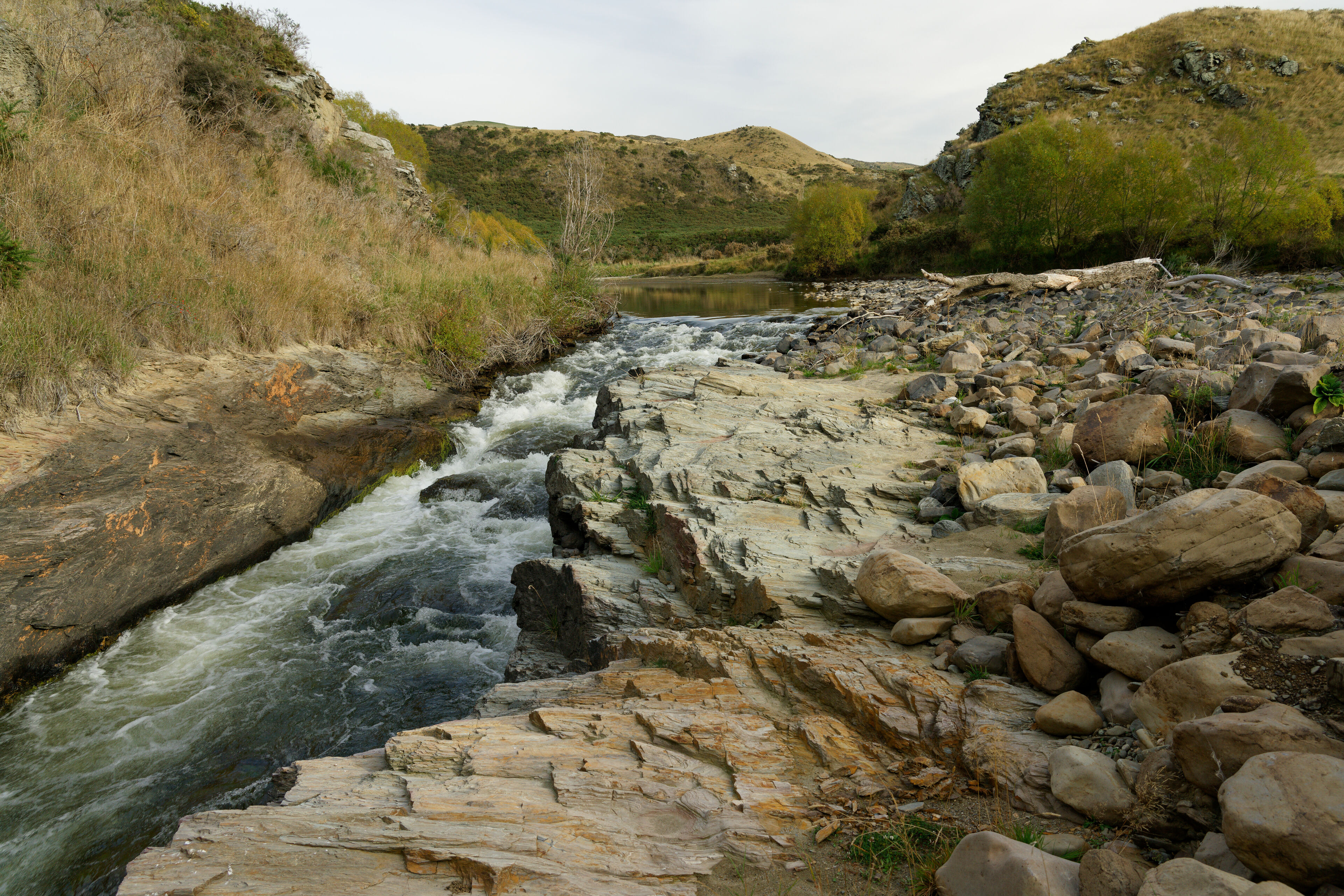
Tunnel Intake.
Tunnel Intake II.
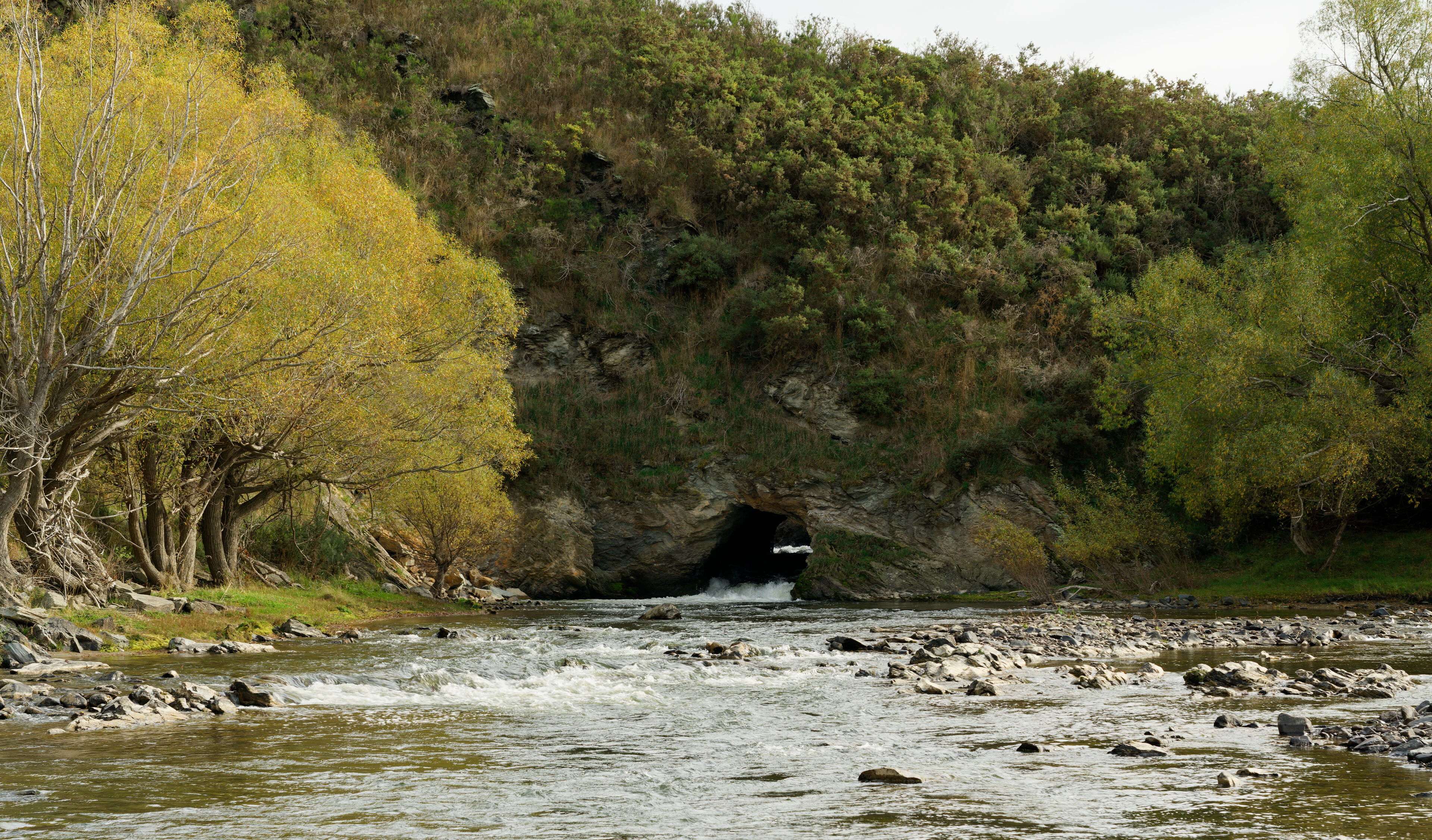
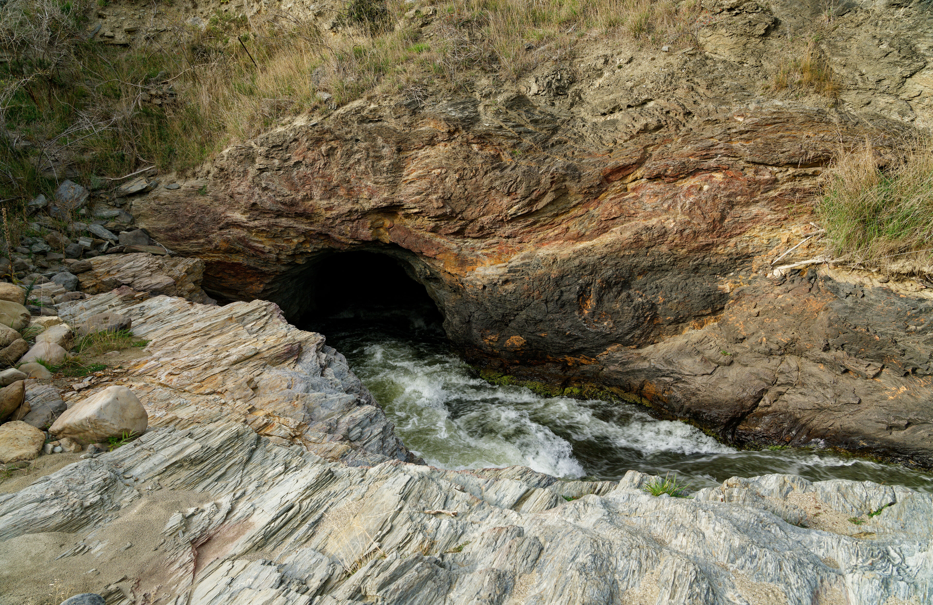
Tunnel Outlet.
The area is accessible to walkers with a marked track down to the tunnel intake from the Rail Trail. To get to the tunnel outlet you need to walk around the river bed and bush bash through gorse and rosehip bushes in places where water makes the river impassable. It looks like water still runs through this stretch of the river so after heavy rain or during spring snow melt there may be no option to walk around the bend.
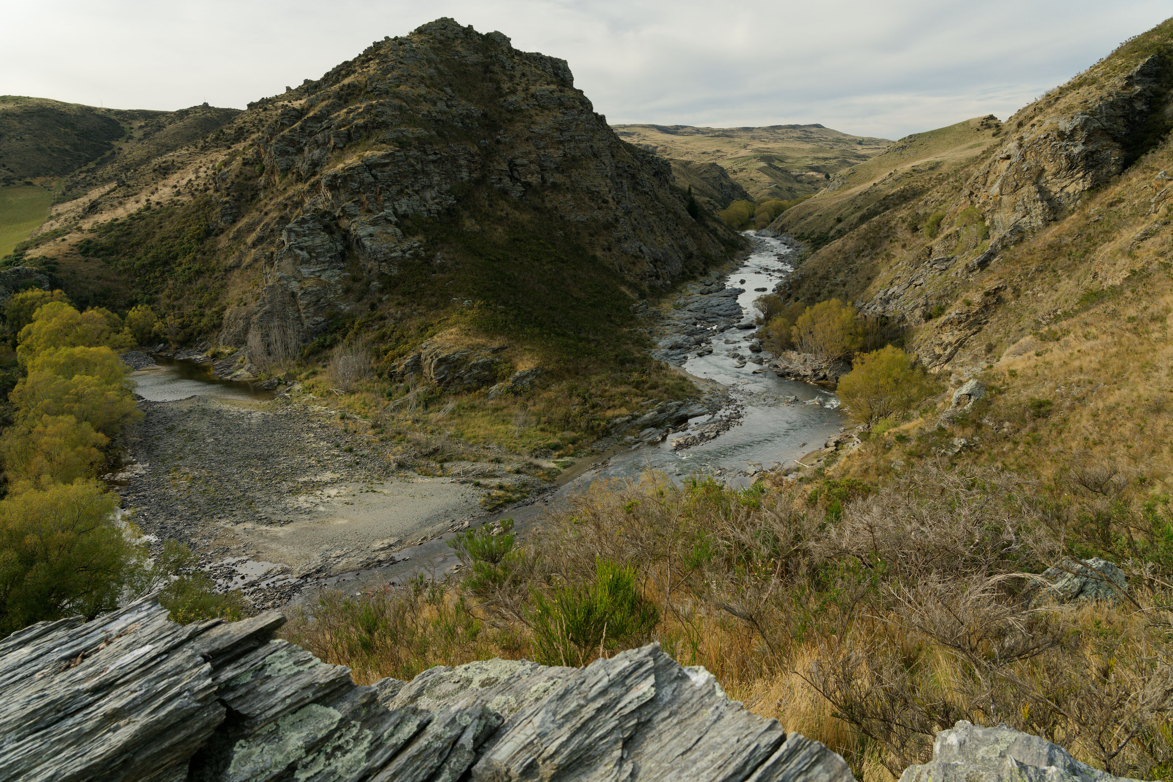
Note the mullock mid left of the frame below. It may be from mining the river bed, but could equally be from mining the hills above.
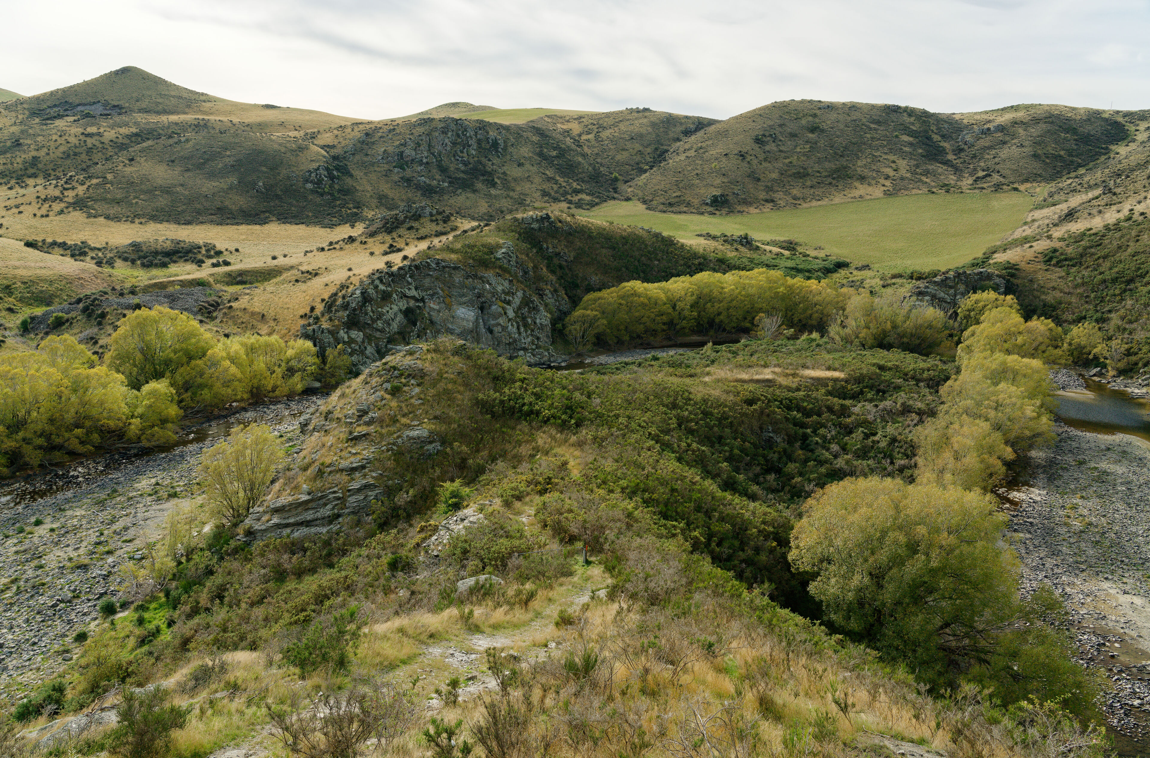
The path down to the river bank. Tunnel intake is out of shot, to the bottom left. The Tunnel outlet is at the bottom right of the frame.
Looking downstream from the tunnel outlet. The line of willow trees on the left mark out the diverted river bed.
Further Reading
Nothing on the tunnel itself, but plenty on the history of Hyde.
- East of the Rock and Pillar: A History of the Strath Taieri and Macraes Districts, 1949, H.M. Thompson.
- Early History in Otago, Otago Witness, 14 March 1906
- Goldfields Reminiscences: The Early Days of Hyde, Otago Witness, 22 August 1906
- Goldfields Reminiscences, Otago Witness, 29 August 1906
- Goldfields Reminiscences (Concluded), Otago Witness, 12 September 1906
- Early History of Hyde, Mount Ida Chronicle, 17 February 1911
- Early History of Hyde, Mount Ida Chronicle, 24 February 1911
- Early History of Hyde: The Battle of the Landless, Mount Ida Chronicle, 19 May 1911